Hiking Bright Angel Trail To Indian Garden at the Grand Canyon
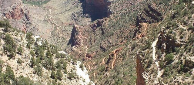
The day preceding our hike on the Bright Angel Trail at Grand Canyon National Park , saw Bob and me taking it easy and making the necessary preparations for our lengthy endeavour. We purchased lots of salty snacks, lunch supplies, energy bars and fruit, knowing full well that the demands on our bodies would probably be the most extreme we had ever experienced. With our alarm set for 4 a.m., and plans to hit the trail by 5 a.m., Bob and I intended to retire early, but in the end, we hit the hay about the same time as usual…10:30 p.m. We were full of anticipation and trepidation. Were we really up to the task?
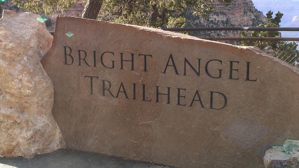
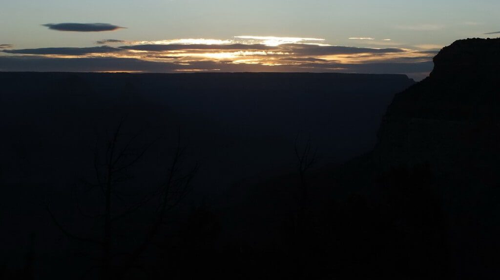
After a quick breakfast of cereal, yogurt and fruit in our room, we walked the short distance to the trailhead that is very close to Bright Angel Lodge. We were amazed at how bright the horizon already was upon waking at 4:15 a.m. and could have actually planned an earlier departure, but as it was, we placed our first footsteps on Bright Angel Trail at 5 a.m. sharp! The light had grown in that subtle predawn way with nothing as blatant as a sunbeam, but rather landscape features emerged gradually from the depths of darkness as the shadows cloaking them changed from black to grey, then blue.
Because the nighttime temperature near the Rim often dipped to the low and mid 30F. range, the air was quite brisk on our skin. Bob and I wore sweaters, as recommended, but we soon concluded that they were unnecessary. Even though we would be hiking on the shaded side of the Trail for a good share of the morning, the farther hikers descend into the Canyon, the warmer the temperature becomes.
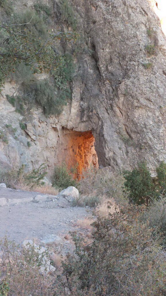
Not far from the outset of Bright Angel Trail, the path passes through a couple of different tunnels or arches. In my photo, you can see that the morning sun is lending an orange glow to the inside of this first tunnel,
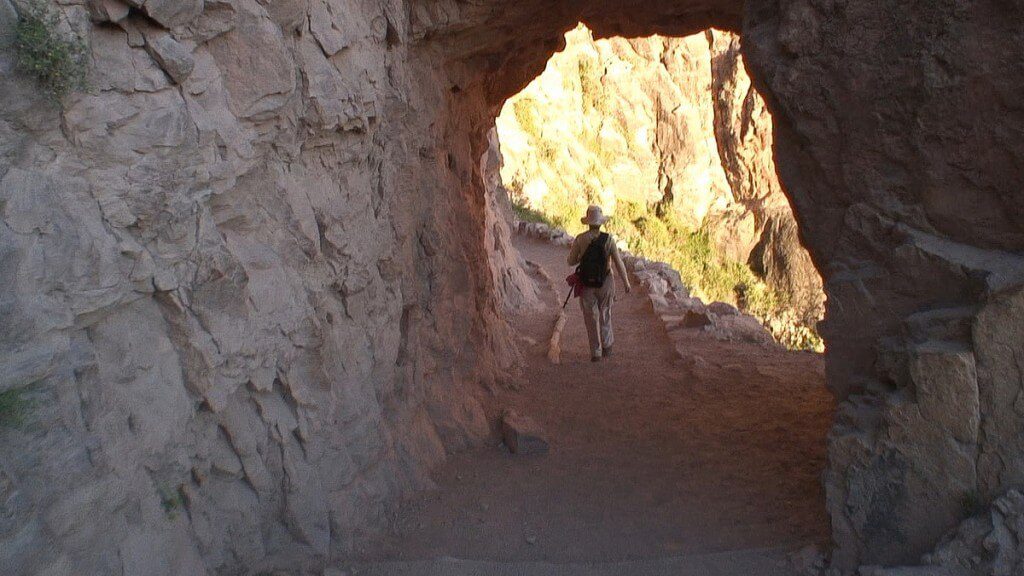
and here, I am walking in the shade beyond the second arch. The trail’s surface was good underfoot, consisting of fine sand that insinuated itself into every crease and crevice. I carried in my backpack 4 peanut butter and jam sandwiches, cheddar cheese, two apples, carrot sticks, 4 energy bars and two bags of trail mix/peanuts. We hoped we were adequately outfitted for the day’s adventure.
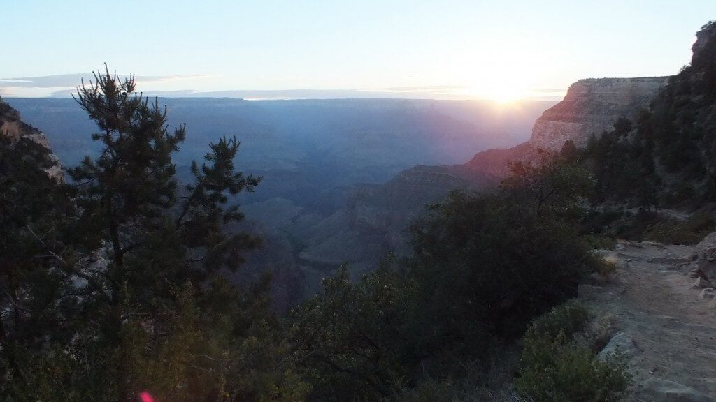
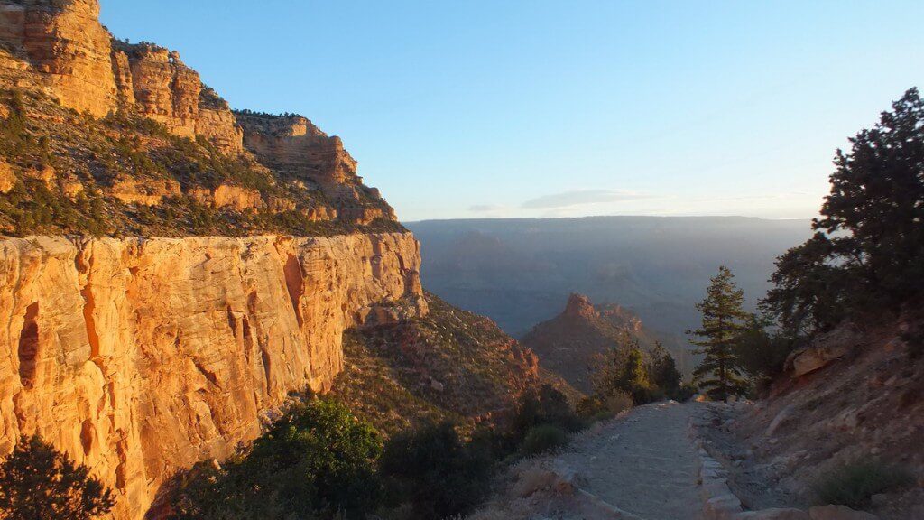
With each passing minute, we could see the shadows receding down the cliffs and buttes as the warm yellow sunshine washed over the tops of the plateaus. For me, to witness the dawn of a new day has always been magical. Just knowing that, since the beginning of time, man has relished that same first break of light at dawn and has reveled in its warmth and illumination instills in me the conviction that all things are possible. I was so excited that I could hardly contain myself.
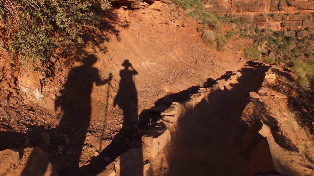
The red sand was radiant under the early morning sunshine, and provided an amazing canvas for my and Bob’s shadows. In his backpack were 2 litres of water plus our 2 water bottles, first aid supplies, batteries, flashlights and our sweaters, which had been promptly shed when barely underway.
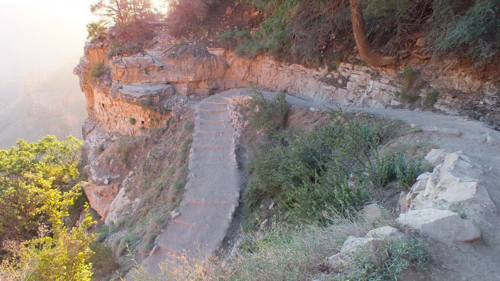
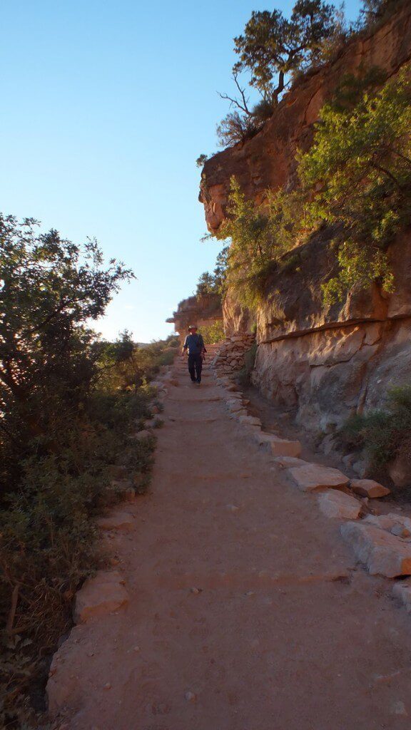
We found Bright Angel Trail to be a well-maintained dirt path lined with rocks so there was never any mistaking the direction to follow. Significantly-sized rocks, in some cases, were employed in the more dangerous areas so Bob and I never felt at risk of falling “over the side”. Switchbacks are cut into the cliff faces of the Bright Angel Fault to establish a path to the 3 resthouses: Mile-and-a-Half Resthouse, Three-Mile Resthouse, and Indian Garden Resthouse.
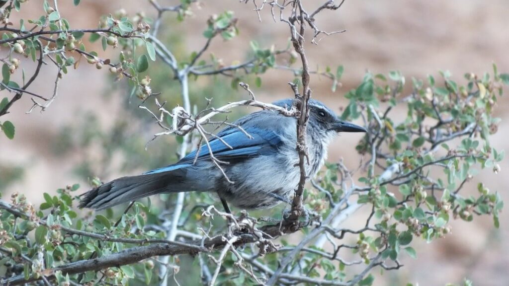
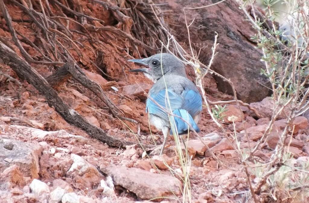
Bob and I made slower headway than some other hikers on the Trail because we took time to stop and photograph various animals, plants and birds along the way. For days, we had been catching glimpses of the Western Scrub Jays (Aphelocoma californica) along the South Rim, so when this one landed near us at the side of the trail, we had to capture a few pictures. That was on the first section of the hike, about 10 minutes walk down into the Canyon.
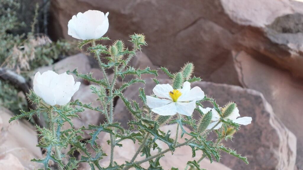
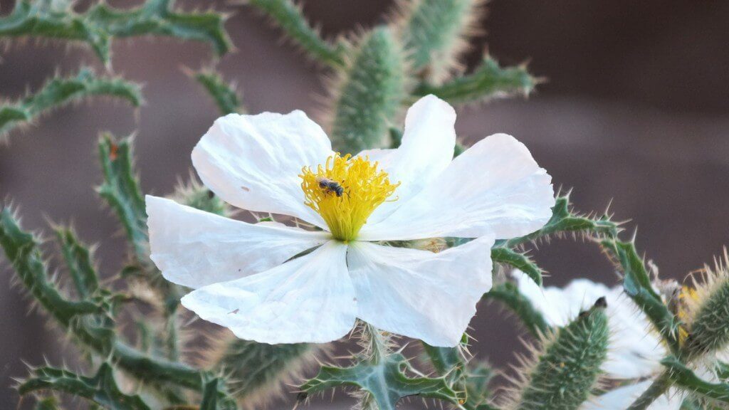
An intriguing plant seen growing up between some boulders had me moving in for a closer look. Later, we identified the plant as an Arizona Prickly Poppy (Argemone arizonica). Surprisingly, this species of plant is endemic to the Grand Canyon only along the North Kaibab Trail and the Bright Angel Trail, and its preferred habitat is on a south-facing slope…which is exactly where we found it.
This rare native plant is also called Roaring Springs Prickly Poppy, and it is of concern to conservation authorities. The delicate flower of this thistle-like perennial sits atop sprawling stems that are densely covered with spines. Likewise, the leaves are prickly, so I had to be careful not to touch the plant when taking pictures. This particular plant was already displaying some of the spindle-shaped fruits that are like a 3-lobed capsule.
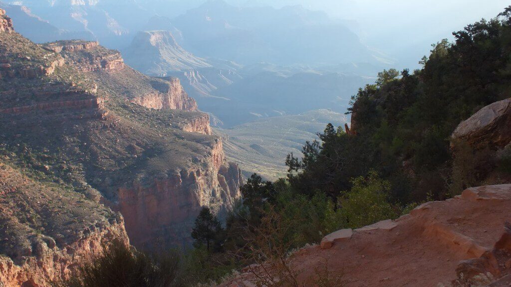
From a point a little further on, Bob and I had a distant view of Plateau Point, our final destination of the downward hike. The faint white line that is the trail crosses the plateau in the centre of this photograph and leads to the look-off point above the Colorado River.
Although the downward descent along the switchbacks was on a gradual slope, it wasn’t long before Bob and I employed our hiking sticks to alleviate the strain on our knees.
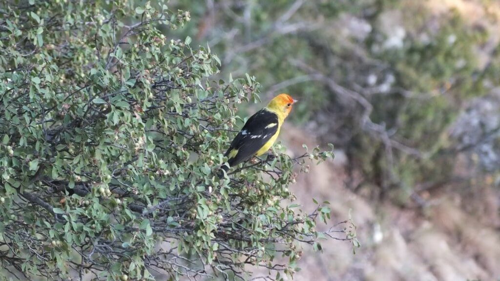
We were thoroughly savoring the cool air on our skin and the lack of direct sunshine and so were moving along at a good pace until a brilliant flash of yellow drew our eyes to a shrub on the Canyon wall. A Western Tanager (Piranga ludoviciana), likewise enjoying the early morning temperature, had us once again pausing to snap a few pictures.
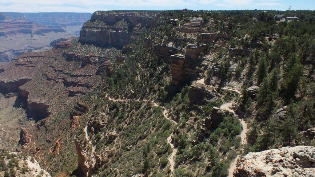
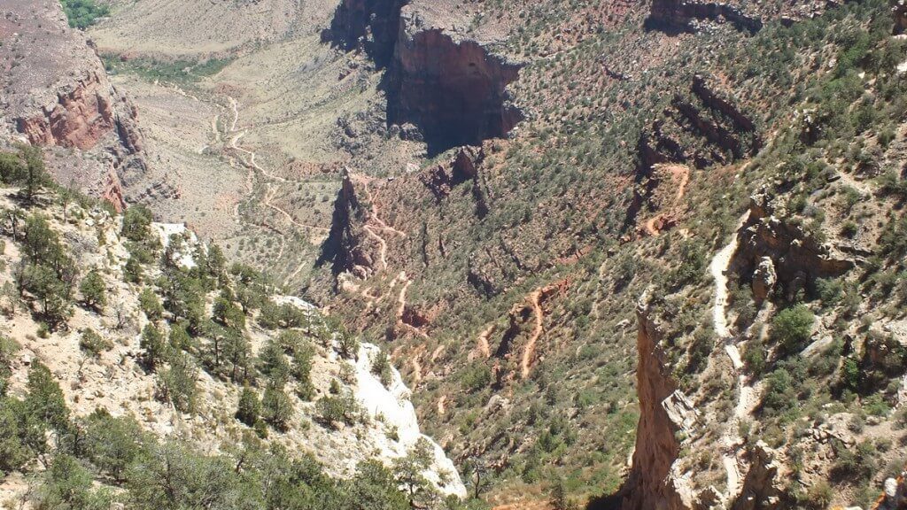
Endless switchbacks are the necessary means by which Bright Angel Trail traverses the steep and dangerous slopes from the South Rim to the Inner Canyon.
From this high up, Bob and I wondered how the trail could possibly get around the obstacles and conduct us to Three-mile Resthouse, seen on the pinnacle at the centre of this photo. The roofed shelter is at the point of the outcrop, and the little white speck is the washroom building set back from the trail.
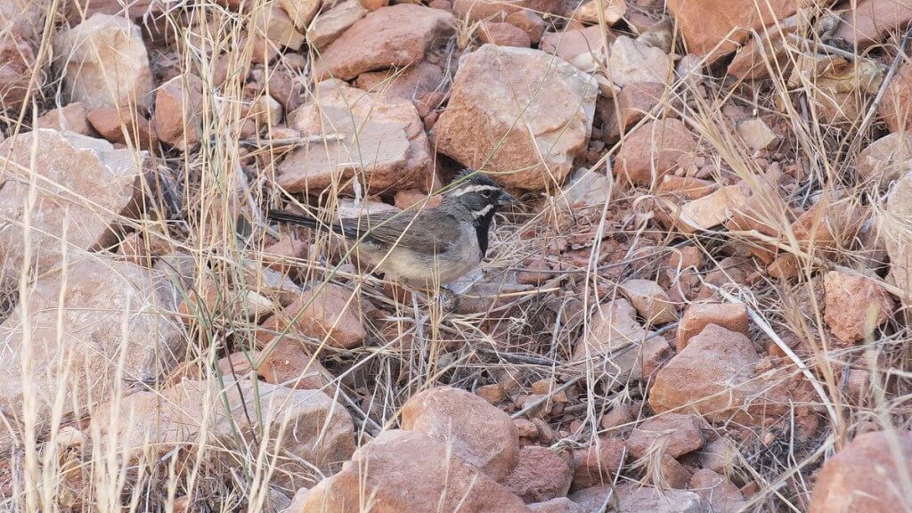
As we got nearer Three-Mile Resthouse, a flicker of movement in the pebbles beside the trail had Bob and me discovering another new bird: a Black-throated Sparrow (Amphispiza bilineata). This attractive sparrow with its delightful song is also referred to as a Desert Sparrow because of its preferred habitat on arid desert hillsides and scrub.
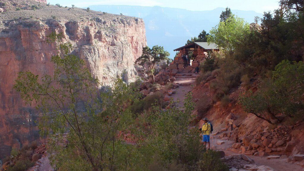
I was quite surprised at the substantial proportions of the building known as Three-Mile Resthouse. Any construction along Bright Angel Trail would present significant challenges to be overcome. This resthouse sits at the top of the Redwall Formation, part of a limestone layer that is one of the most prominent layers in the canyon. It can be up to 500 feet high. Only for the Bright Angel Fault, this sheer cliff would be impenetrable.
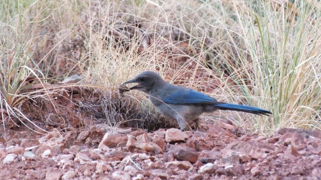
Like the shelter at Mile-and-a-Half Resthouse, a source of drinking water is provided so hikers can refill their water bottles. Bob and I had been hiking for 2 hours by the time we reached the 3-mile mark, so we took time for some salty snacks and filled our bellies with water. During the brief sojourn, numerous Scrub Jays were foraging in the dirt nearby for what looked like pebbles; we figured the objects must be acorns or juniper berries.
The striking blue plumage of the Scrub Jays was highlighted by the contrasting rust-coloured sand and stones. The Redwall Cliff has become red from iron compounds leaching into it, made possible by the water soluble limestone. That also accounts for the numerous caves and alcoves found in that layer.
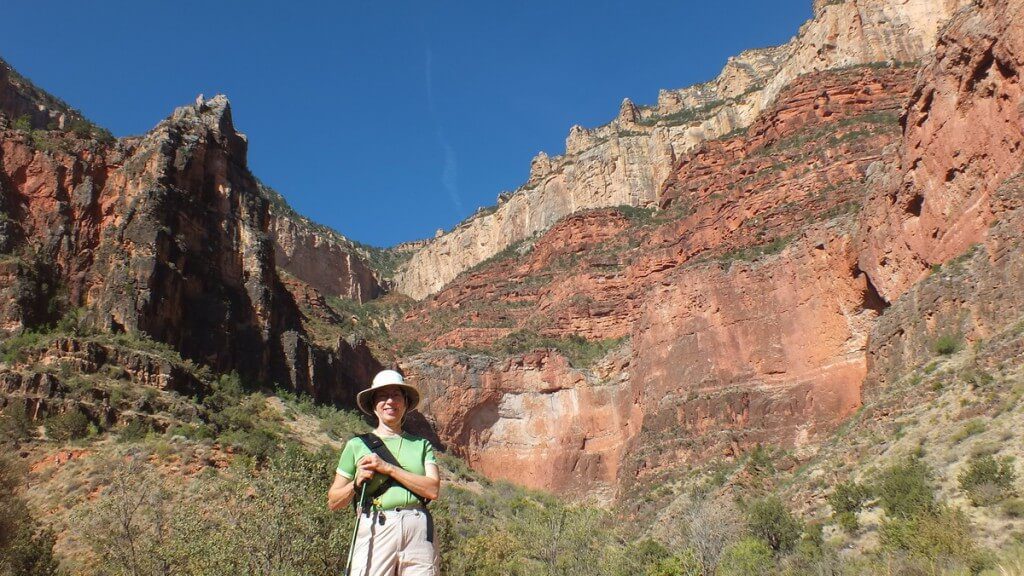
The cliffs and terraces of the Grand Canyon exhibit strata of many different colours, and with the rising sun softly lighting the canyon, the reds and blues, oranges and yellows of the striations were more pronounced. Bob snapped a picture of me that demonstrates the delineation between layers. With the Canyon being over a mile deep, the rock strata represent two billion years of deposits. The top layer is called the Coconino Sandstone layer. Below that, the pink Hermit Shale layer, has fern and cone-bearing plant fossils preserved within it. Fossilized tracks of reptiles and amphibians can be found in the Supai Group, the layer upon which I am standing.
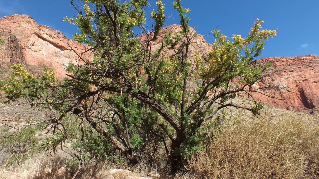
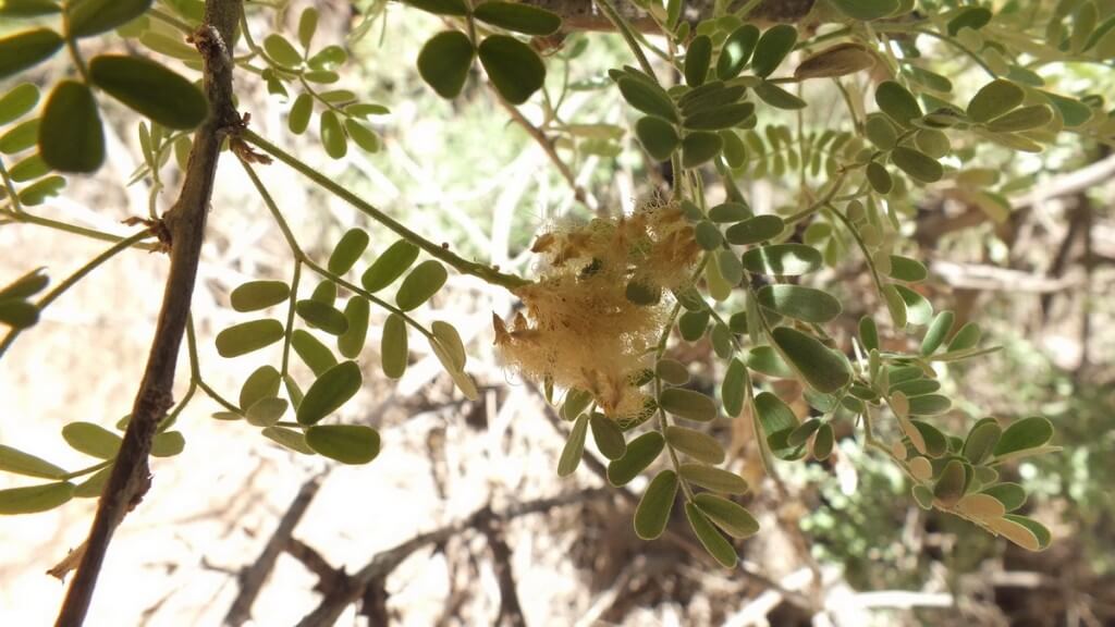
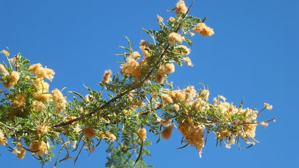
The series of switchbacks below Three-Mile-Resthouse is referred to as Jacob’s Ladder, and they traverse the sheer Redwall Cliff that is the dividing line between forest and desert-scrub habitats. Bob and I could see the changing biospheres as evidenced in the trees and shrubs. This interesting bush is called Catclaw Acacia (Acacia greggii). Not readily visible along the stems are the hooked barbs that lend this plant its name…thorns that are the shape and size of a cat’s claw.
The Catclaw Acacia and other plants in that lower-elevation desert had smaller leaves to prevent water loss, and what vegetation existed was sparse and close to the ground.
Catclaw Acacia has a fascinating list of alternate names, Catclaw Mesquite, Devil’s Claw and Wait-a-Minute Tree to name a few, and all relate to the hooked prickles that snag passersby and force them to “wait a minute” to safely extract the spikes from their clothing or skin. In this photograph, you can see that the shrub has already formed its year’s growth of seed pods.
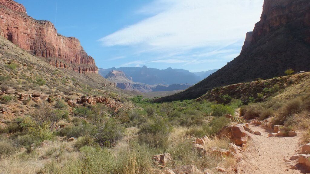
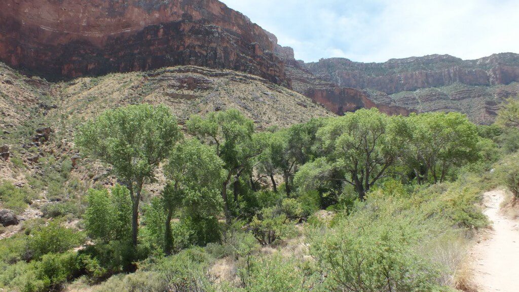
As we approached Indian Garden, a series of basins and arroyos or gulches made our passage a little more pleasurable. Those stream beds are usually dry except following heavy rains, and water sources deep below support a different community of vegetation than is found on the hotter, drier slopes surrounding them. Western Redbud, Single-leaf Ash, Cliff Rose, Willow, Arizona Grape and Mesquite Trees were among those flora that stood out and provided the welcome green approach to the oasis. Already, we could see a concentration of taller trees in the near distance.
It was so exciting to see the changing landscape as we moved further down the trail. The clock was nearing 9:30 a.m., and Bob and I were getting hungry, but an unexpected surprise in one of the trees once again had us putting our own needs on hold.
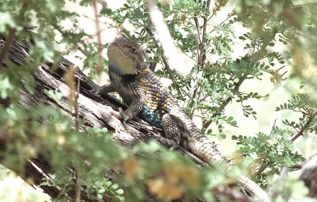
Lolling unobtrusively on the branch of a Catclaw Acacia, tucked in behind the tiny leaves, was a well-camouflaged lizard. Its pale body matched very well the sun-bleached bark, yet the lizard’s scales showed a tinge of yellow and turquoise in addition to the predominant neutral shades of black and white. Later research identified the creature as a Yellow-backed Spiny Lizard. This particular lizard is a male, identifiable by the bright blue-green patches on its sides and throat.
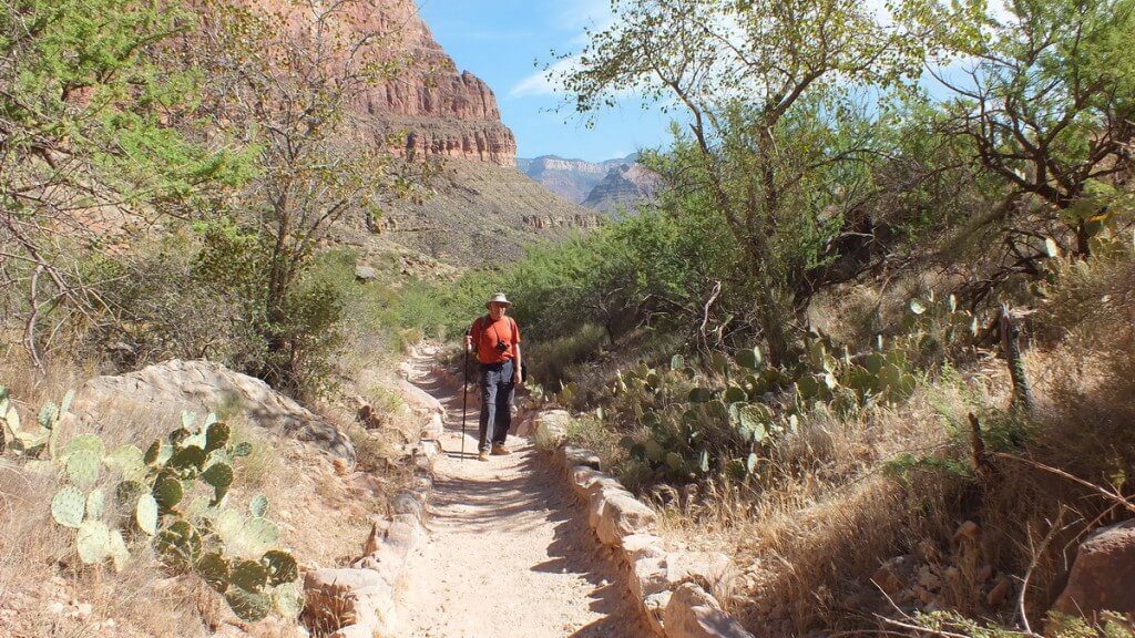
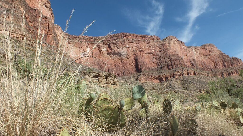
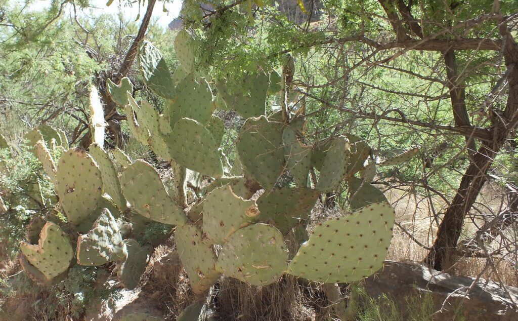
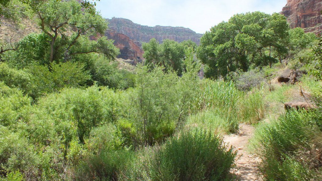
Moving on, we soon found Indian Garden a sheer delight because there, the vegetation took a further dramatic turn. Out of the dry, sandy soil had grown healthy, broad cacti,
some as tall as me,
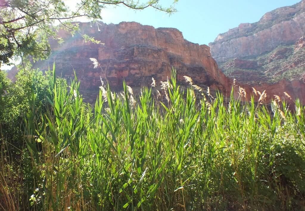
dense stands of slender marsh grasses that swayed and rustled in the passing gusts of wind,
thickets of lush green shrubs beside the trail,
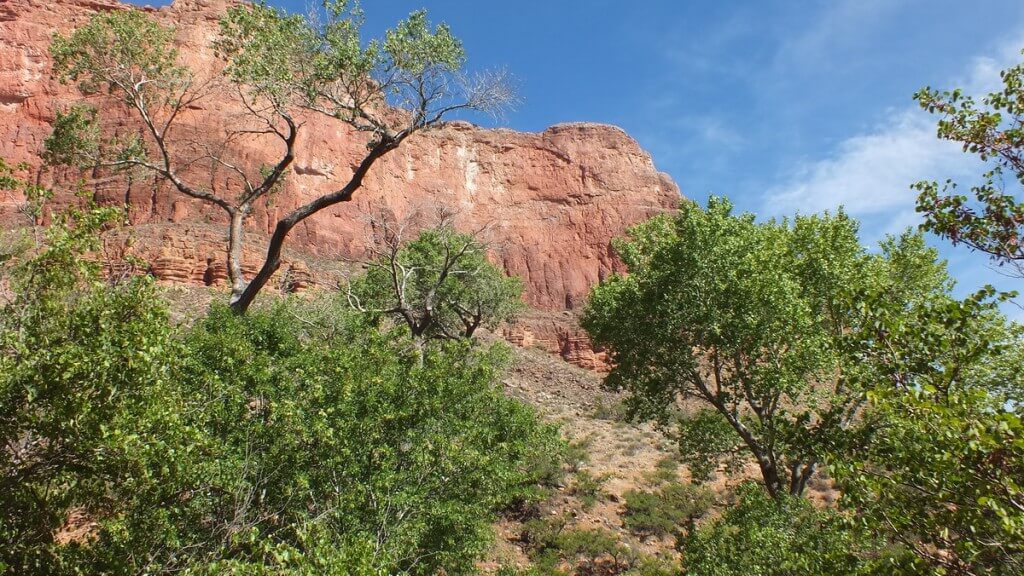
and large Cottonwood Trees that thrashed in the wind. They seemed totally incongruous with the arid landscape.
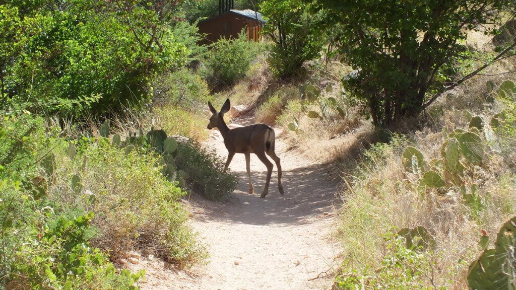
A young Mule Deer, drawn to the oasis either for cool shade or a refreshing drink of water, sauntered along the trail in front of Bob and me. Being careful not to startle it, we quietly observed the diminutive deer before it moved off into the dry grasses beneath a tree.
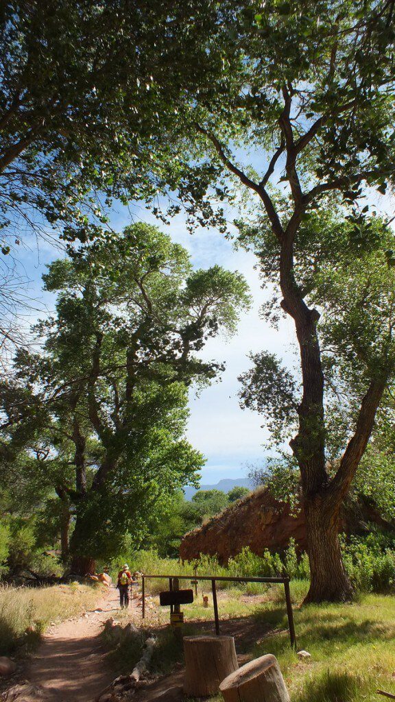
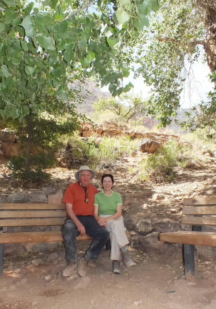
Wonderfully shaded by the soaring Cottonwood Trees were several park benches much used by hikers for a brief respite from the heat. Also in the shaded enclave is a small pond that reflected the brilliant sunshine where it was able to penetrate the thick leaf cover of the tree canopy.
There, at 9:30 a.m., Bob and I enjoyed our first lunch of the day, then prepared to head out across the open Tonto Plateau. The temperature was already 100F. so Bob and I soaked our neckerchiefs in cold water, and I wet my hair and Tilley hat to stave off the heat on the sun-exposed trail. We had already hiked 4.6 miles and would cover another 1.5 miles before reaching Plateau Point above the Colorado River. We filled our six water containers to the brim, added some electrolyte tablets and set off.
It was hard to leave the lush surroundings of the oasis behind, especially knowing that the next leg of our hike was across the open desert. The mercury was still climbing, windy, dry conditions were the norm for the day, and there would be no escaping the relentless sun.
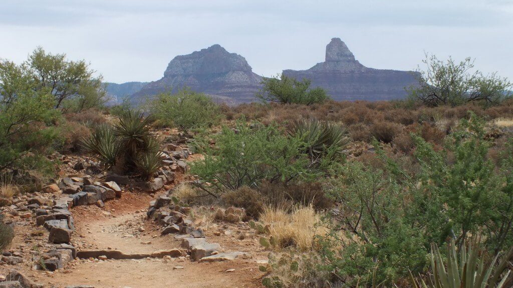
Plateau Point Trail crosses the Tonto Platform and leads hikers on, essentially, a straight route to a fantastic view of the Inner Gorge and Colorado River.
Frame To Frame – Bob and Jean

I hope you did not do this hike in the summer! I’ma grand canyon addict from France! There is another hike worth doing if you have the strength and time: Down the Tanner trail to Tanner rapid and then on the Beamer Trail due east to the Little Colorado confluence. It’s an amazing hike but requires at least 3 to 4 nights in the canyon to appreciate and not get exhausted. Also there is no water on the trail down to the Colorado and you must filter thoroughly the water you take in the river.I usually carry 5 liters of water per day and cache water at the bottom of the first cliff of the Tanner trail to recover it on the hike out. I’ll post in the near future a video of my hike there on youtube or dailymotion. You pictures are superb and it’s rare to see condors in the position you photographed them! AFter Tanner and the Beamer you’ll consider Bright Angel an easy hike! Regards from Paris, Claude
Thanks for your in-depth comment, Claude. We hiked the Bright Angel Trail in early summer, mid-June, and that was certainly more than hot enough for us to bear. We were thinking, when we return to the Grand Canyon, to do the South Kaibab Trail. It is definitely a very special place there. Thanks for looking.
The south Kaibab has great views, but be aware there is no water from top to bottom. The best moment if end of May early June. Never hike out through South Kaibab. You might be interested with the GCFI (Grand Canyon field Institute); they organize hikes with very interesting rangers, Wayne Ranney among them is a geologist; I hiked with him from North to South rim. Contact on my behalf Mike Buchheit who is the director of GCFI. He’ll be of good advice and is a very close friend. We met 20 years ago when he organized a hike for me in place of one of the Institute’s I could not manage to get in as it was sold out. He nicknamed me “Béarnaise”‘. If you tell him you’ve been in contact with Béarnaise he’ll immediately know who it is!!!! If you’re interested check out my videos here https://vimeo.com/user18137868/videos (the password is claude) . I’m re-editing my different videos hikes as to post them in my french blog-book on hikes in GCN and other parts of the four corners. I noticed there was nothing very serious in France on the matter and people are really taking very dangerous attitudes when going down there.
Thanks for the input, Claude. Your recommendations will be taken to heart whenever we decide to head back to Grand Canyon National Park. I will be sure to check out your videos, too.
What an endurance test! If I go…I take the mule train.
Cheers
Bill…
Without a doubt, Bright Angel Trail represents the longest and most grueling hike that Bob and I have ever undertaken. It certainly tested the limits of our capability, but it was a challenge that we set for ourselves, and we both felt thrilled to have accomplished it. The extreme heat and elevation changes are what set this hike apart from other lengthy hikes that we have undertaken. Thanks for reading our blog.